Tardajos
Tardajos es un municipio del Alfoz de Burgos (Castilla y León), situado 10 km al oeste de Burgos capital provincial. Se asienta a 827–850 m de altitud, en la confluencia de los ríos Arlanzón y Úrbel, y lo cruza de este a oeste el Camino de Santiago Francés. Con 864 habitantes (INE 2024), su casco histórico —de traza medieval— conserva el papel de villa de paso y de acogida para el caminante que avanza hacia Rabé de las Calzadas, Hornillos del Camino o por la variante Vía Aquitania.
Alojamientos en Tardajos


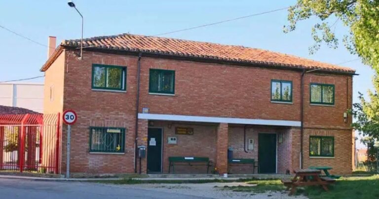
Tardajos on the Camino Frances
El Camino Francés atraviesa Tardajos de este a oeste, configurando su calle principal. El pueblo ha sido durante siglos punto de descanso y abastecimiento antes de la dura etapa hacia Rabé de las Calzadas y Hornillos del Camino, ya en plena meseta cerealista.
Itinerario en la villa
- Entrada desde Burgos: el peregrino llega tras cruzar el río Úrbel.
- Recorrido urbano: la ruta discurre entre casas tradicionales, fuentes y la plaza central.
- Iglesia de la Asunción: punto de referencia espiritual y arquitectónico.
- Salida hacia Rabé: pista agrícola abierta, sin sombra, donde conviene cargar agua.
Qué ver en el Camino
- Iglesia de la Asunción de Nuestra Señora (s. XIII–XVI): nave gótica, cabecera cuadrada, torre medieval con remate barroco y portada neoclásica.
- Puente del Úrbel y Puente del Arzobispo: herederos de la tradición viaria.
- Crucero y fuentes: símbolos de acogida y referencia devocional.
Consejos prácticos para peregrinos
- Verano: madrugar para evitar insolación, llevar agua y gorra.
- Invierno: ropa cortavientos; frecuentes heladas y viento del noroeste.
- En bici: atención al barro arcilloso tras lluvias, especialmente en el tramo a Rabé.
Tardajos en la Vía Aquitania
Tardajos se asienta sobre la Vía Aquitania, heredera directa de la calzada romana Astorga–Burdeos, eje fundamental de comercio y cultura. Este corredor conectaba la Meseta con el valle del Ebro y, más allá, con la Galia.
En época medieval, esta misma ruta fue seguida por peregrinos procedentes de Aquitania y Gascuña, consolidando Tardajos como punto de paso internacional.
Albergues en Tardajos
Deobrígula and the Roman legacy
The El Castro archaeological site reveals the village’s role in antiquity: control of the valley, strategic visibility and farming of the river meadows. The remains found there led to its listing as a Site of Cultural Interest (1994).
What to see in Tardajos?

The thousand-year history of Tardajos
Pre-Roman and Roman origins: Deobrígula
The hill known as El Castro holds the Deobrígula archaeological site, occupied from the Early Iron Age through Roman times. Pottery, wall remains, bronzes and inscriptions found here confirm the importance of this settlement. In Roman times, Tardajos was a mansio (waystation) on the imperial road network, linked to the great roads:
- Ab Asturica Burdigalam (Road XXXIV): from Astorga to Bordeaux.
- Ab Asturica Terracone (Road XXXII): from Astorga to Tarraco via Cesaraugusta.
The Roman settlement was known as the “City of the Gods” and was a key link on the Vía Aquitania, a route that centuries later would become a pilgrim road to Compostela.
Middle Ages: resettlement and charters
In the year 882, under Alfonso III, Tardajos was incorporated into the defensive line of the County of Castile along the Arlanzón. In 1127, Count Pedro de Lara and Doña Eva granted the Fuero of Burgos to the council of Tardajos, reinforced in 1147 with privileges for knights and foot soldiers. The village is already mentioned in the Becerro de las Behetrías (1352), under a dual jurisdiction: episcopal and hospitaller (Hospital del Rey and the Order of St John of Acre).
During the Late Middle Ages the village had two parishes (Santa María and La Magdalena) and several hermitages, forming a devotional landscape tied to the pilgrim route.
Modern and Contemporary Era
18th- and 19th-century censuses describe it as a prosperous village, with grain, flax, wine and abundant fishing in its rivers. In 1749 it still had two distinct quarters and six hermitages. During the 19th and 20th centuries it underwent urban changes, but has preserved the linear medieval layout typical of villages along the Camino.
An unbroken cultural corridor
Today, reading the landscape reveals this historical continuity:
- Field patterns and irrigation systems that already existed in Roman times.
- Bridges and bridle paths that replace ancient fords.
- Place names and archaeological remains that recall Tardajos’s role as a communications hub.
Geography and nature of Tardajos
- Average altitude: 850 m.
- Terrain: rolling plateaus with concave profiles toward the valleys.
- Rivers: Arlanzón and Úrbel, lifelines for irrigation and daily life.
- Climate: continental, with mild summers and cold winters.
- Protected nature: Tardajos lies within the “Riberas del Arlanzón y afluentes” Site of Community Importance, with rich riparian biodiversity, including the southern damselfly (Coenagrion mercuriale).
Economy and local life
Historically, Tardajos has been an agricultural village: wheat, barley, legumes, market gardens and sheep farming. Today irrigated agriculture remains a mainstay, complemented by pilgrim tourism and Camino-related services.
Tardajos today: a living village on the Camino de Santiago
Travellers find a peaceful centre with bars, shops, fountains and hospitality. Its scale allows a stop without straying from the route, offering rest and supplies before the open stretch toward the meseta.
Tardajos’s charm lies in its dual identity: an active pilgrim village and heir to the Roman Vía Aquitania, which make it an essential stop for both pilgrims and cultural travellers.
Tardajos
In Tardajos, walkers tread two of Europe’s great routes at once: the Camino Frances and the Vía Aquitania. The village offers tangible history, a legible landscape and human-scale services, making it a smart stop both for pilgrims and for anyone seeking to understand how great roads have shaped Burgos since antiquity.
| Country | Spain | |
|---|---|---|
| Autonomous community | Castile and León | |
| Province | Provincia de Burgos | |
| District | Alfoz de Burgos | |
| Judicial district | Burgos | |
| Location | 42°20′50″N 3°49′09″O | |
| Altitude | 828 m | |
| Area | 12.80 km² | |
| Population | 799 inhabitants (2023) | |
| Density | 62.03 inh./km² | |
| Demonym | tardajeño, tardajeña | |
| Postal code | 09130 | |
| Website | www.tardajos.es | |