Calzada del Coto
Calzada del Coto is a small municipality located in the Provincia de León, within the autonomous community of Castilla y León, Spain. It is part of the Tierra de Sahagún comarca and the judicial district of Sahagún. The municipality comprises the villages of Calzada del Coto and Codornillos.
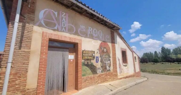
Hostels in Calzada del Coto

History and Toponymy of Calzada del Coto
The area has been inhabited since prehistoric times, as evidenced by Neolithic and Chalcolithic finds. During the Roman era, the Via Trajana ran through the region, facilitating the settlement of Roman colonists. The name “Calzada del Coto” comes from this Roman road and its dependence on the Monastery of Sahagún, initially being known as “Villa Zacarías” and later as “Villa Calzata“. The suffix “del Coto” first appeared in 1333, indicating its role as the head of the monastery of Sahagún’s estate.
What to see in Calzada del Coto?

Calzada del Coto on the Camino de Santiago
Calzada del Coto is a stage on the Camino Frances. From here, pilgrims can choose to continue along the Roman Road towards Calzadilla de los Hermanillos or along the Camino Real towards Bercianos del Real Camino. The municipality has the San Roque pilgrims’ hostel, opened in 2014.
Geography and Climate of Calzada del Coto
The municipality covers an area of 56.03 km² and is located in the south-east of the province of León, in the Tierra de Sahagún comarca. The average elevation is 820 metres above sea level, with gentle terrain and flat river valleys. The climate is continentalized Mediterranean, with annual rainfall of around 550 mm, concentrated in spring and autumn. Average annual temperatures range between 10 and 12°C, with cold winters and hot summers.
Demographics of Calzada del Coto
According to 2023 data from the Instituto Nacional de Estadística (INE), Calzada del Coto has a population of 222 inhabitants, with a population density of 4.4 inhabitants/km². The population is ageing, with an average age of 57.85 years, and a low birth rate. The municipality has experienced population decline since the mid-20th century, mainly due to rural exodus.
Economy
The local economy is based mainly on the primary sector, with dryland and irrigated farming standing out, including crops such as the Tierra de Campos lentil, which has held Protected Geographical Indication (PGI) status since 2006. Livestock farming, especially sheep and cattle, is also significant.
Heritage and Culture in Calzada del Coto
Festivities: One of the most notable celebrations is the “Carro de la Hoguera” (Bonfire Cart), in which young people turning 18 (quintos) play a leading role.
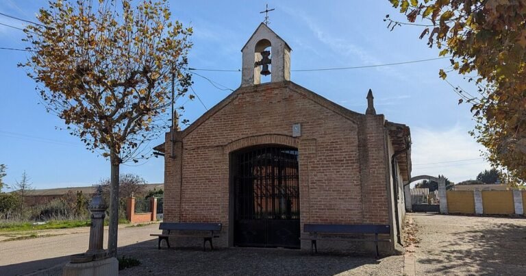
Religious architecture: Notable are the Iglesia de San Esteban, of medieval origin, and the Ermita de San Roque, built in 1885 on the site of an earlier church.
Traditional architecture: The vernacular architecture is characterised by the use of adobe and rammed earth, with one- or two-storey houses and pitched roofs. Also notable are the wine cellars dug into the ground, traditionally used for wine ageing.
Calzada del Coto
| Country | Spain | |
|---|---|---|
| Autonomous community | Castilla y León | |
| Province | Provincia de León | |
| Comarca | Tierra de Sahagún | |
| Judicial district | Sahagún | |
| Mancomunidad | Zona de Sahagún | |
| Location | 42°23′15″N 5°04′50″O | |
| Elevation | 820 m | |
| Area | 56.03 km² | |
| Settlements | Calzada del Coto y Codornillos | |
| Population | 223 inhabitants (2024) | |
| Density | 4.3 inhabitants/km² | |
| Demonym | cuqueto, cuqueta | |
| Postal code | 24342 | |
| Dialling code | 987 | |
| Patron saint | San Esteban (26 de diciembre) San Roque (16 de agosto) | |
| Website | www.aytocalzadadelcoto.es | |