

Profile
Castillo de Castrojeriz
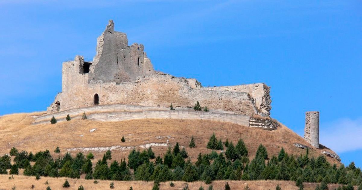
In the Odra-Pisuerga region of Burgos, about 42 km west of the city of Burgos, the Castillo de Castrojeriz rises on a hill topping 900 m in elevation. The town of Castrojeriz sits right along the Camino de Santiago Frances, between the stages connecting Hontanas and Boadilla del Camino, making the castle’s silhouette a visual landmark for pilgrims and travelers crossing the meseta.
General Overview of the Monument
Overlooking a rocky spur that was easy to defend, the castle preserves the layout of several walled enclosures, remains of a keep, cisterns and walls reinforced with corner towers. Although its current construction is the result of medieval rebuilds and later consolidation work, the site shows evidence of ancient occupation and a defensive continuity that explains its strategic position over the valley.
Brief Historical Timeline of the Castillo de Castrojeriz
- Early Middle Ages (8th-10th centuries): consolidation of an initial fortified site making use of the terrain. Its role was to control the natural corridor between the Pisuerga and Arlanzon river basins.
- 11th-13th centuries: integration into the resettlement policy of the County and later Kingdom of Castile; the castle was reinforced to guard roads, revenues and land holdings.
- 14th-15th centuries: a period of expansion, with thicker walls and work on the main tower; local records and tradition recall courtly episodes and noble conflicts that raised its political importance.
- Early Modern period: gradual loss of its military function; occasional repairs were carried out after earthquakes and storms.
- 19th-20th centuries: deterioration and partial ruin; consolidation campaigns in the final third of the 20th century and early 21st century to secure walls and access points.
Historical note: the claim of a Roman or Caesarian founding belongs to local tradition repeated in popular sources; the castle’s visible appearance and construction are largely the result of medieval building phases.
Architecture and Notable Features of the Castillo de Castrojeriz
Defensive Enclosures and Walls
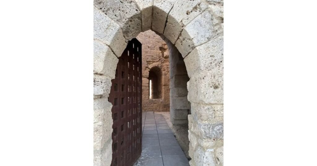
The complex is arranged across three levels of defense that follow the shape of the hill. The surviving sections show very thick walls (around 2.5-3 m in key areas), built of local limestone rubble and ashlar bound with lime mortar, and cylindrical reinforcements (turrets) at exposed corners. Arrow slits for bows and crossbows point to Late Medieval renovations.
Keep and Adjoining Rooms
At the center once stood the keep, now ruined above ground, of which the springing points of vaults and internal supports remain. Around it were arranged storerooms, a parade ground and service rooms. The current layout makes it possible to trace the overlapping building phases.
Cisterns and Water Management
In the courtyard, excavated and lined cisterns can still be identified, essential to the site’s self-sufficiency in the event of a siege, with intake openings protected from the elements.
Castrojeriz on the Camino Frances: Living Heritage
The town retains the linear layout typical of a town-road settlement. From the castle, visitors can look out over a historic network of churches, hospitals and inns that served pilgrims for centuries. A short distance from the hill are:
- The Iglesia de San Juan (Gothic with later additions), a focal point of Jacobean traffic.
- The Church of Our Lady of the Apple Tree, home to a deeply venerated Marian image.
- The ruins of the Convento de San Anton, whose Gothic arch straddles the historic road and forms one of the most photographed spots for pilgrims.
Legends and Courtly Episodes
Local memory links the castle to tales of noble intrigue and royal confinement. Later chronicles and traditional accounts mention a queen named Leonor associated with the castle in the 14th century, an episode that, beyond legend, underscores the site’s political significance in the Late Middle Ages.
Practical Visit: Getting There and What to Expect
Access
- From Burgos (approx. 40 km) via the N-120 heading west.
- From Palencia (approx. 50 km) via the P-431 connecting to the N-120.
- Parking is available in town, followed by a walk up along a signposted path leading to the top of the hill.
Duration and Difficulty
- Climb: 20-35 minutes from the village, depending on pace.
- Difficulty: low to moderate; a steady incline with rocky ground in places.
Recommendations
- Footwear with good grip and protection against the meseta’s wind.
- Best light for photography is at sunrise (backlighting over the plain) and sunset (warm tones on the walls).
- Avoid climbing in bad weather; the hilltop is highly exposed.
Reading the Landscape from the Castillo de Castrojeriz
The natural viewpoint makes it possible to identify:
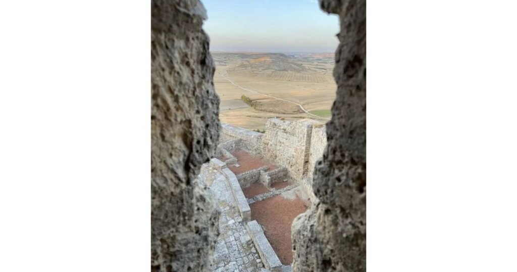
- The Odra river valley and its patchwork of dry-farmed grain fields.
- Old farm service roads tracing historic routes.
- The route of the Camino Frances, visible as a line of pilgrims during the high season.
Building Materials and Techniques of the Castillo de Castrojeriz
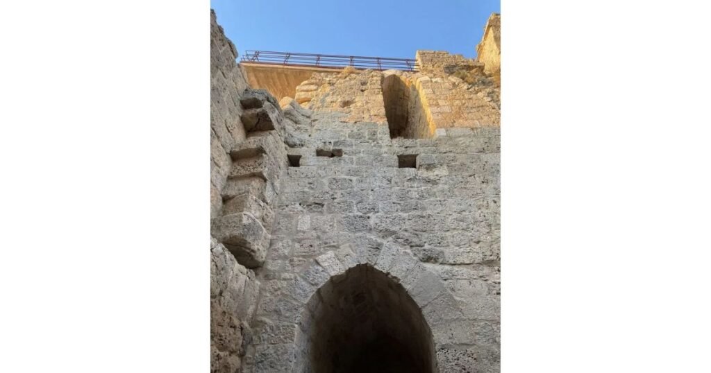
The masonry combines ashlar at corners, gateways and reinforcements, with rubble stonework across the wall faces. Lime mortar with local aggregates was used, along with small stone chips as filler and wedges. The original roofs of the main chambers were vaulted; today only the springing points and supports survive, in a state of stabilized ruin.
State of Preservation and Safety at the Castillo de Castrojeriz
The castle shows stabilized ruin in key sections, with restored wall segments and areas marked off with barriers. Visitors are advised not to climb on the walls, to respect closed-off areas and to take extra care near exposed edges. The exterior can be freely visited; possible restrictions or cultural events may affect access to interior platforms.
Must-See Surroundings (Within 25-30 km)
- Fromista (Iglesia de San Martin, a gem of Palencia Romanesque architecture).
- Itero de la Vega and its medieval bridge over the Pisuerga.
- Sasamon (historic center and collegiate church).
These sites round out the story of Romanesque and Gothic art along the Camino across the meseta.
Useful Information About the Castillo de Castrojeriz
- Hill elevation: ~900 m.
- Type of visit: exterior and stabilized ruin; no services at the summit.
- Climate: continental meseta climate; summers with intense sun exposure and cold, windy winters.
- Accessibility: the path up is not wheelchair accessible; people with reduced mobility are advised to enjoy the views from lookouts within the town itself.
- Province: Burgos (Castilla y Leon)
- Municipality: Castrojeriz
- Access: N-120; signposted walking route up from the village
- Visit duration: 1-2 hours (castle + viewpoints)
- Interest: medieval defensive architecture, meseta landscape, Jacobean heritage
Castillo de Castrojeriz
The Castillo de Castrojeriz captures the spirit of the Camino Frances: vast landscape, historical memory and Jacobean hospitality. Its outline, visible for miles, accompanies walkers and offers one of the widest panoramas along the route between Burgos Province and Palencia Province. Anyone crossing the meseta will find in this fortified hilltop an elevated pause from which to take in the geography, the rhythms of the land and the deep history of the Camino de Santiago.
Plan your visit for early morning or late afternoon, bring sun and wind protection, and round out the climb with a walk through town past its historic churches and hospitals. Even in ruins, the site offers a complete heritage experience along the central stretch of the Camino de Santiago Frances.
Camino de Santiago Frances >> Burgos Province >> Castrojeriz >> Castle de Castrojeriz
Map
Sorry, no records were found. Please adjust your search criteria and try again.
Sorry, unable to load the Maps API.