Camino Frances Stage Route: Pamplona – Puente la Reina (24 km)
This stage of the Camino de Santiago Frances links Pamplona with Puente la Reina over about 24 kilometers. It is a moderately difficult day shaped by a single major obstacle — the climb, and above all the descent, of the Sierra del Perdon — and by a highly symbolic finish: the point where the Camino Frances and the Camino Aragones merge into a single route to Santiago. Along the way: vineyards of the Valdizarbe, Romanesque churches and the detour to the octagonal chapel of Eunate.
KM 0

Pamplona
Leave the old town of Pamplona along Calle Mayor, pass the Church of San Lorenzo — home to the Chapel of San Fermin — and cross the Taconera park. The Camino skirts the Vuelta del Castillo and the University of Navarra campus, leaving the city along a pedestrian walkway, crossing the Sadar river, toward Cizur Menor.
4.8 km

Cizur Menor
A residential district on the outskirts of Pamplona with every service. Next to the Camino stand the Romanesque fortress-church of San Miguel Arcangel and the Order of Malta albergue. Here the last city streets end and a long, steady climb begins on farm tracks, with the Sierra del Perdon and its wind turbines always ahead.
11.2 km
Zariquiegui
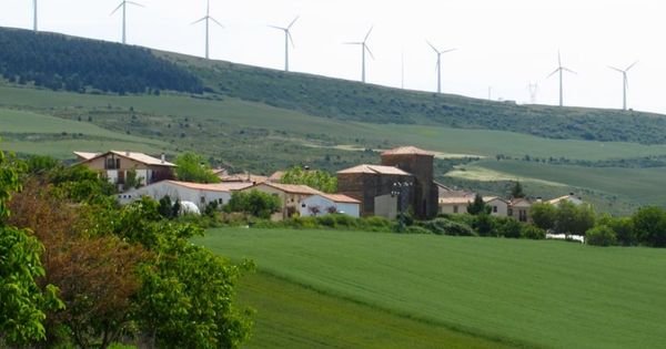
A small village in the Cizur valley, with the 13th-century Romanesque Church of San Andres and the last bar and shop before the summit. Leaving it, the Camino turns genuinely steep: about 2.5 km of continuous climbing, with sections close to 15%, passing the Fuente de la Reniega — dry almost year-round and the setting for the legend of the pilgrim tempted by the devil — up to the Alto del Perdon (790 m), the highest point of the stage. At the top, along the ridge of the wind farm, stands the sculpture group in cut sheet metal “Where the path of the wind crosses that of the stars”, with views over the Pamplona basin and the Valdizarbe.
17.2 km
Uterga
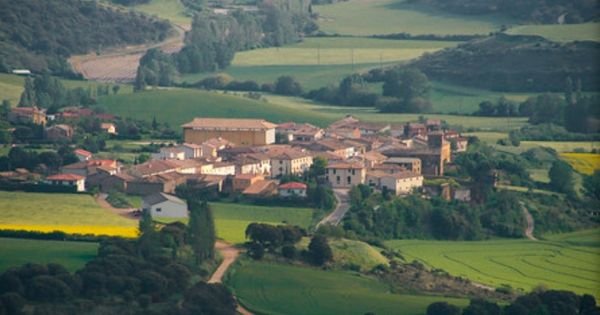
The descent from the Alto del Perdon is about 2.5 km over a path of loose stone and uneven steps, harder on the knees than the climb itself and slippery in the rain; go down slowly and use trekking poles. Uterga, already in the Valdizarbe, has a fountain, a bar and several albergues. From here the terrain softens among rolling hills of grain and vineyard.
20 km
Muruzábal
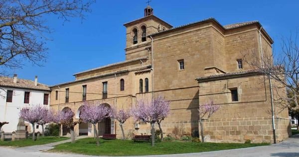
A village with fine examples of Navarrese manor architecture. At the entrance, a signposted detour to the left — a little over 1 km — leads to the Ermita de Santa Maria de Eunate, a 12th-century gem of rural Romanesque architecture with an octagonal floor plan and an arcaded gallery, wrapped in Templar and funerary legends; it is worth checking the opening hours. The official Camino continues straight ahead.
21.8 km

Obanos
A town of arcaded streets and houses bearing coats of arms, with an archway leading to the square and the Church of San Juan Bautista. Every two years, the Misterio de Obanos, a medieval play about the legend of San Guillen and Santa Felicia, is performed here. The route leaves on a downhill path that, shortly before Puente la Reina, joins the branch arriving from the Camino Aragones.
24 km

Puente la Reina
At the junction with the Aragones route stands the pilgrims’ monument and the plaque “and from here all roads become one.” In the town itself, the Iglesia del Crucifijo — of Templar origin, with a Y-shaped crucified Christ brought from Germany — and the Iglesia de Santiago, with the carving of Santiago Beltza (“the Black”). The stage ends by crossing the famous six-arched Romanesque bridge over the Arga river, built in the 11th century for pilgrims and a symbol of the town.
Pamplona – Puente la Reina: Complete Guide
Stage Profile: Distance, Elevation and Difficulty
Distance: 24 km (23.9 km on the official route). Walking time: 5 h 30 min – 6 h. Elevation change: about +415 m of climbing and –505 m of descent. Difficulty: moderate (2 out of 5); suitable for most pilgrims, with a single tricky section.
By section: Pamplona – Cizur Menor (4.8 km, urban and flat); Cizur Menor – Zariquiegui (6.4 km, a gentle climb on farm track); Zariquiegui – Alto del Perdon (2.4 km, 260 m of ascent, the final third quite steep); Alto del Perdon – Uterga (3.6 km of steep, rocky descent); Uterga – Muruzabal – Obanos – Puente la Reina (final 7 km over gentle grain and vine hills). By bike, the Perdon descent is unrideable: you either walk it down or go around via the road (Astrain – Legarda).
The Alto del Perdon
This is the defining feature of the stage. From Zariquiegui, the last village with services before the ridge, the Camino climbs 2.4 km to the 790 m summit, with grades nearing 15% on the final stretch. Halfway up you pass the Fuente de la Reniega, almost always dry, tied to the legend of a thirsty pilgrim to whom the devil, disguised as a fellow walker, offers water in exchange for renouncing God, the Virgin and Saint James. At the top, beneath the line of wind turbines, stands the pilgrims’ monument by Vicente Galbete (1996): a procession of iron figures on foot, on horseback and mounted, with the inscription “Where the path of the wind crosses that of the stars.” The views take in the Pamplona basin and the Pyrenees behind, and the whole Valdizarbe ahead. The descent toward Uterga is 3.6 km over loose stones and uneven steps: slower and harder on the knees than the climb, and dangerous in rain or ice.
What to See: Monuments and Heritage
Pamplona sends pilgrims off with its walled old town: the Cathedral of Santa Maria la Real, with a Gothic cloister considered one of the finest in Europe; the Citadel and its bastions; the Portal de Francia; Plaza del Castillo and the bull-running Calle Estafeta. Leaving the city, you cross the Puente de la Magdalena (12th–13th century) over the Arga. In Cizur Menor, the Romanesque fortress-church of San Miguel Arcangel, of the Order of St. John of Jerusalem. In Zariquiegui, the Romanesque Church of San Andres (13th century) with an elaborate doorway. At the Alto del Perdon, the sculpture group described above. From Muruzabal you can detour 1 km to the Ermita de Santa Maria de Eunate, a 12th-century Romanesque octagonal chapel surrounded by an arcaded gallery, traditionally linked to the Templars and to pilgrim burials. Obanos preserves the archway leading to the Church of San Juan Bautista. And Puente la Reina brings together the Iglesia del Crucifijo — with a Y-shaped crucifix of Germanic origin —, the Iglesia de Santiago — home to the image of Santiago Beltza — and its 11th-century Romanesque bridge of six arches over the Arga.
A Bit of History
Pamplona — Roman Pompaelo, founded by Pompey, and the historic capital of the Kingdom of Navarre — owes much of its medieval layout to the Camino: the boroughs of Navarreria, San Cernin and San Nicolas, partly settled by Franks, grew up around the pilgrim route and even fought each other until the Privilege of the Union (1423) merged them into a single city. This stretch is already described in the 12th-century Codex Calixtinus. Puente la Reina, Gares in Basque, was founded as a resettlement town to serve pilgrims; its bridge was built in the 11th century — tradition credits a queen, either Dona Mayor of Castile or Dona Estefania — so that walkers could cross the Arga without depending on boatmen who overcharged them. This is where the Camino Frances arriving from Roncesvalles meets the Camino Aragones entering via Somport and Jaca: hence the motto on the monument at the edge of town.
Food of the Valdizarbe and Pamplona
Before leaving Pamplona, a round of pintxos along Calle Estafeta, San Nicolas and around Plaza del Castillo is well worth it. This part of Navarre offers Denomination-of-Origin asparagus and piquillo peppers, pochas (tender white beans), vegetable menestra, lamb chilindron, trout a la navarra, and Idiazabal and Roncal cheeses. The Valdizarbe is wine country: garnacha rosés and reds under the Navarra D.O., with wineries open to visitors around Muruzabal and Obanos. To finish, a pacharan, the region’s typical sloe liqueur.
Practical Tips
Leave Pamplona early. The ridge of the Sierra del Perdon is fully exposed to sun and wind — there is a wind farm up there for a reason — so it is worth reaching the top before the midday heat. Water: there are fountains in Cizur Menor and Zariquiegui, but none on the climb itself, and the Fuente de la Reniega is usually dry; carry at least a liter and a half in summer. Perdon descent: use trekking poles, take short steps, and wear shoes with good grip on loose rock; in rain or mud, take extra care. Services (bar and/or shop) in Cizur Menor, Zariquiegui — the last one before the summit —, Uterga, Muruzabal, Obanos and Puente la Reina. The visit to Eunate adds about 2 km round trip from Muruzabal and has limited opening hours (worth checking beforehand). In summer, with the arrival of pilgrims from the Camino Aragones, Puente la Reina fills up early: book ahead if you can.
Services and Accommodation by Village
Listings published in our guide for the villages on this stage. Zariquiegui, Uterga, Muruzabal and Obanos do not yet have accommodation or heritage listings in the guide.
Pamplona
Hostels
- Hostel Aloha Hostel Pamplona
- Hostel Casa Ibarrola Pamplona
- Hostel de Jesus y Maria
- Hostel Plaza Cathedral Pamplona
Accommodation
- Guesthouse Arriazu Pamplona
- Hotel Alda Centro Pamplona
- Hotel Avenida Pamplona
- Hotel Castle de Javier Pamplona
- Hotel Ciudadela Pamplona
- Hotel NH Pamplona Iruña Park
- Hotel Pamplona Cathedral
- Hotel Pompaelo Urban SPA Pamplona
Churches
Cizur Menor
Hostels
Puente la Reina
Hostels
- Hostel de los Padres Reparadores
- Hostel Estrella Guía Puente la Reina
- Hostel Gares Puente la Reina
- Hostel Puente
- Hostel Santiago Apóstol Puente la Reina
Accommodation
Churches