
Camino Frances: Stages, Distances and How to Plan Them
The Camino Frances is the busiest and best waymarked of all the pilgrim routes leading to Santiago de Compostela. It runs for around 780 kilometres which, by tradition and by how albergues and services are spread out along the way, are divided into 34 stages: 34 days of walking from Saint-Jean-Pied-de-Port, at the foot of the French Pyrenees, to the Praza do Obradoiro. The first stage crosses the mountains and the last one arrives at the Cathedral of Santiago; between the two, this page brings together the full route stage by stage, with the distance of each one and a link to its detailed guide.
The 34 Stages of the Camino Frances, from Saint-Jean-Pied-de-Port to Santiago de Compostela

Stage 1: Saint-Jean-Pied-de-Port – Roncesvalles
The first stage of the Camino Frances is one of the toughest, as it involves crossing the Pyrenees. The climb out of Saint-Jean-Pied-de-Port is steep and demanding, but the panoramic mountain views reward pilgrims for the effort. The stage ends in Roncesvalles, a small village known for its historic collegiate church.
Stage 2: Roncesvalles – Zubiri (21.4 km)
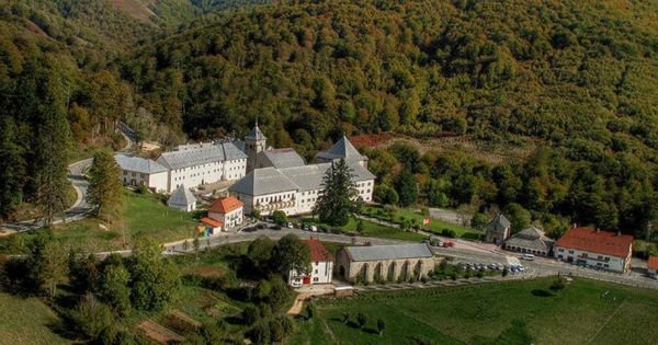
Stage 2: Roncesvalles – Zubiri (21.4 km)
From Roncesvalles, the path descends through beech and oak forests down to Zubiri. This stage is gentler, with easier terrain, though the length of the day still makes it physically demanding. Along the way, pilgrims cross the iconic Puente de la Rabia before entering the village.
Stage 3: Zubiri – Pamplona (20.4 km)
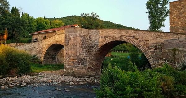
Stage 3: Zubiri – Pamplona (20.4 km)
Pamplona, the capital of Navarra, is the destination of this third stage. World-famous for the Running of the Bulls (Sanfermines), Pamplona offers pilgrims a mix of culture, history and food. Along the way, pilgrims cross the iconic Puente de la Rabia before entering the city.

Stage 4: Pamplona – Puente la Reina (24 km)
This stage takes pilgrims through small villages and farmland to Puente la Reina, a medieval town known for its striking Romanesque bridge over the River Arga. It’s a place steeped in history, where several Camino routes converge.
Stage 5: Puente la Reina – Estella (22.6 km)

Stage 5: Puente la Reina – Estella (22.6 km)
The fifth stage heads into the wine country of Navarra. Estella, known as “the little Toledo”, is a town with a rich historical and architectural heritage. Pilgrims can enjoy the Church of San Pedro de la Rua and the Palace of the Kings of Navarra.
Stage 6: Estella – Los Arcos (21.8 km)

Stage 6: Estella – Los Arcos (21.8 km)
As pilgrims head towards Los Arcos, the landscape starts to change, with sweeping vineyards and farmland. Los Arcos is a small town where the Church of Santa Maria is a notable landmark.
Stage 7: Los Arcos – Logroño (28 km)
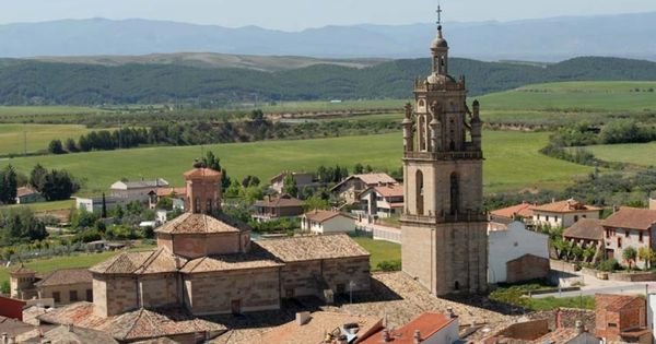
Stage 7: Los Arcos – Logroño (28 km)
This stage takes pilgrims from Los Arcos to Logroño, crossing the border between Navarra and La Rioja. It’s a region famous for its vineyards, where you can enjoy the celebrated Rioja wine. Logroño, a city with a rich wine and food tradition, offers a well-earned rest with its famous tapas on Calle Laurel.
Stage 8: Logroño – Nájera (30.4 km)

Stage 8: Logroño – Nájera (30.4 km)
Continuing through La Rioja, this stage takes pilgrims to Nájera, known for its striking Monastery of Santa Maria la Real. The path through vineyards and open fields reflects the calm of the region.

Stage 9: Nájera – Santo Domingo de la Calzada (21 km)
This section of the Camino runs through farmland to Santo Domingo de la Calzada, where legend tells how a pilgrim was miraculously saved from death by the saint the town is named after. The town’s cathedral is a must-see stop for walkers.

Stage 10: Santo Domingo de la Calzada – Belorado (22.7 km)
The route heads into Castilla y Leon, entering the Provincia de Burgos. Belorado, a small town with a rich medieval history, has sights worth a look, such as its church and main square.
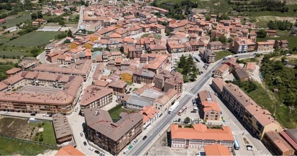
Stage 11: Belorado – San Juan de Ortega (24 km)
This stretch is known for its stillness and the natural beauty of its mountain scenery. San Juan de Ortega is famous for the monastery that welcomes pilgrims.
Stage 12: San Juan de Ortega – Burgos (26.6 km)

Stage 12: San Juan de Ortega – Burgos (26.6 km)
On reaching Burgos, pilgrims find a modern city with a striking historic centre, dominated by the famous Catedral de Burgos, a UNESCO World Heritage Site.
Stage 13: Burgos – Hornillos del Camino (19.8 km)
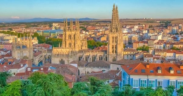
Stage 13: Burgos – Hornillos del Camino (19.8 km)
Leaving Burgos behind, the Camino enters the vast plains of the Meseta Central, on the way to Hornillos del Camino. This stage offers a very different landscape and experience, marked by open fields and wide horizons.
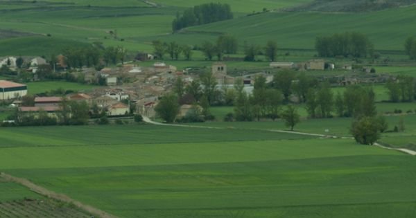
Stage 14: Hornillos del Camino – Castrojeriz (20.6 km)
Continuing across the Meseta, this stage offers stillness and a chance for reflection, with the village of Castrojeriz standing out for its impressive hilltop castle.
Stage 15: Castrojeriz – Frómista (25.4 km)

Stage 15: Castrojeriz – Frómista (25.4 km)
This stage takes pilgrims to Frómista, known for the Church of San Martin, one of the finest examples of Romanesque architecture in Spain.

Stage 16: Frómista – Carrión de los Condes (19.6 km)
The path follows the Canal de Castilla, a change of scenery that offers a calm, flat route to Carrión de los Condes, well known for its monastery and warm welcome to pilgrims.
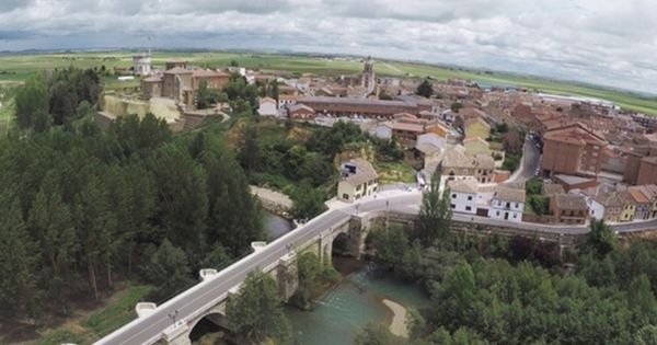
Stage 17: Carrión de los Condes – Ledigos (23.4 km)
A quiet stage along rural tracks and farm paths, taking pilgrims through small hamlets and the vast plain of the Tierra de Campos to Ledigos.
Stage 18: Ledigos – Sahagún (16.2 km)

Stage 18: Ledigos – Sahagún (16.2 km)
Approaching Sahagún, the Camino runs through the heart of the Tierra de Campos, known for its farmland and its deep historical and spiritual significance on the Camino de Santiago.
Stage 19: Sahagún – El Burgo Ranero (17.8 km)
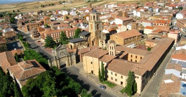
Stage 19: Sahagún – El Burgo Ranero (17.8 km)
This stage, known for its stillness, crosses the Tierra de Campos and is known for its wide horizons and cultivated fields. El Burgo Ranero is a small village offering essential services for pilgrims and a rest at its municipal albergue.

Stage 20: El Burgo Ranero – Mansilla de las Mulas (18.8 km)
Following rural tracks and paths between farmland, this stage takes pilgrims towards Mansilla de las Mulas, a village with notable historic heritage, including remains of its medieval walls.
Stage 21: Mansilla de las Mulas – León (19.7 km)

Stage 21: Mansilla de las Mulas – León (19.7 km)
The stage ends in the city of León, a major milestone on the Camino with its striking Gothic cathedral and other historic monuments essential to understanding the rich history of the route.
Stage 22: León – Hospital de Órbigo (30.6 km)

Stage 22: León – Hospital de Órbigo (30.6 km)
Leaving León behind, pilgrims cross the Roman bridge at Hospital de Órbigo, one of the longest and best-preserved of its kind in Spain.
Stage 23: Hospital de Órbigo – Astorga (16.7 km)

Stage 23: Hospital de Órbigo – Astorga (16.7 km)
This short but significant stage ends in Astorga, where you can visit the cathedral and the famous Episcopal Palace designed by Antoni Gaudi.
Stage 24: Astorga – Rabanal del Camino (21.2 km)

Stage 24: Astorga – Rabanal del Camino (21.2 km)
The route begins to climb gently, approaching the mountains of the Provincia de León. Rabanal del Camino is a traditional village that serves as a resting point before the more demanding mountain stages ahead.
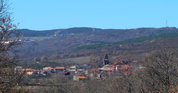
Stage 25: Rabanal del Camino – Ponferrada (35.2 km)
This is one of the toughest yet most spectacular stretches, crossing the Cruz de Hierro, an iconic spot where pilgrims traditionally leave a stone brought from home. The stage ends in Ponferrada, famous for its Templar Castle.

Stage 26: Ponferrada – Villafranca del Bierzo (24.2 km)
This stretch of the Camino offers striking views over the vineyards of El Bierzo and ends in Villafranca del Bierzo, a place of historic significance for pilgrims who could not continue on to the Catedral de Santiago.
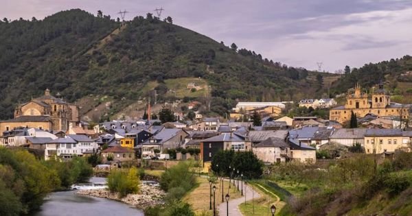
Stage 27: Villafranca del Bierzo – O Cebreiro (27.8 km)
Climbing out of El Bierzo towards Galicia, this stage marks a shift in landscape and culture, ending in the mystical village of O Cebreiro, famous for its church and pallozas.
Stage 28: O Cebreiro – Triacastela (21.7 km)

Stage 28: O Cebreiro – Triacastela (21.7 km)
Crossing the Galician mountains, this stage offers spectacular scenery and takes pilgrims to Triacastela, where the mountain route ends and the descent towards Santiago begins.
Stage 29: Triacastela – Sarria (18.4 km)

Stage 29: Triacastela – Sarria (18.4 km)
This stage lets pilgrims choose between two routes: one via Samos and its ancient monastery, or the more direct path to Sarria, the starting point for many pilgrims because of the minimum distance required to earn the Compostela.
Stage 30: Sarria – Portomarín (22.4 km)

Stage 30: Sarria – Portomarín (22.4 km)
From Sarria, the Camino runs through rural landscapes and villages to Portomarín, known for its Church of San Nicolas, moved stone by stone when the old village was flooded to build a reservoir.
Stage 31: Portomarín – Palas de Rei (24.8 km)
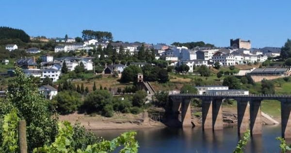
Stage 31: Portomarín – Palas de Rei (24.8 km)
The path continues over gentle hills and eucalyptus woods, with the village of Palas de Rei offering a welcoming rest before the final stages of the Camino.
Stage 32: Palas de Rei – Arzúa (28.5 km)

Stage 32: Palas de Rei – Arzúa (28.5 km)
Linking the Provincia de Lugo and Provincia A Coruña, this stage connects with the Camino del Norte and continues through green, fertile countryside to Arzúa, famous for its local cheese.
Stage 33: Arzúa – O Pedrouzo (19.3 km)
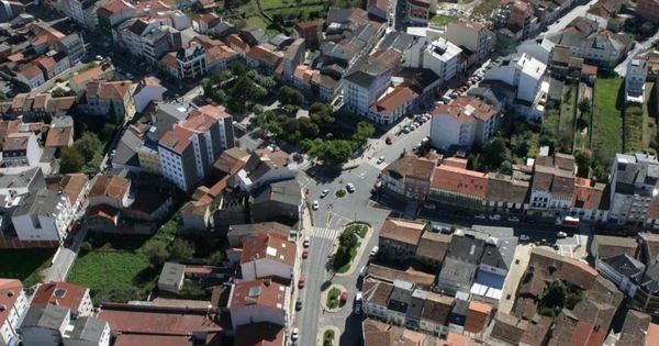
Stage 33: Arzúa – O Pedrouzo (19.3 km)
One of the final stages, passing through woods and meadows to O Pedrouzo, preparing pilgrims for their arrival in Santiago.

Stage 34: O Pedrouzo – Santiago de Compostela (20 km)
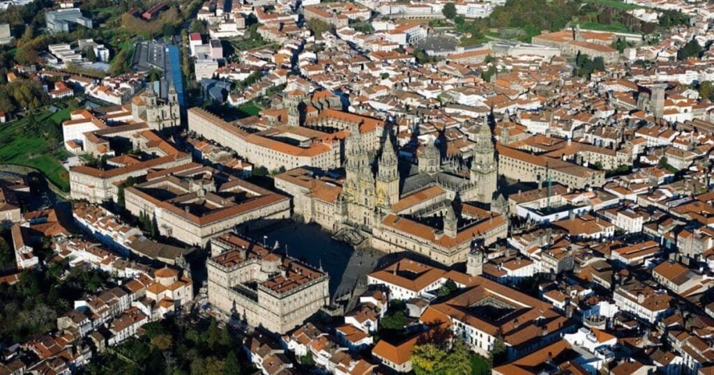
The exciting final stretch of the Camino Frances, where pilgrims cross Monte do Gozo before reaching the Catedral de Santiago in the city of Santiago Compostela, a culminating moment of celebration and spiritual reflection.
How Many Days Does the Camino Frances Take?
Walking the whole route takes a little over a month: at a pace of one stage a day, that’s 34 days of walking, and adding in the odd rest day — in Pamplona, Burgos or León, for example — most pilgrims plan for five to six weeks to complete it at an easy pace. Those with less time available tackle it in sections over several years, or choose a starting point further along the route to fit the Camino to the days they have. Here are the stages organised by the most common starting points:
- Sarria to Santiago — 5 stages / 115 km (5-6 days): the usual starting point for walking just the last 100 kilometres and still qualifying for the Compostela (full details of this stretch in our Sarria to Santiago guide).
- O Cebreiro to Santiago de Compostela — 7 stages / 155 km (about a week): starts already in Galicia, right after the climb to this iconic Camino landmark, just over a week from Compostela.
- Ponferrada to Santiago de Compostela — 9 stages / 207 km (just over a week): starts in El Bierzo, with just over a week of walking before reaching Santiago.
- León to Santiago de Compostela — 13 stages / 311 km (about 2 weeks): starts once the Meseta is behind you, just over two weeks from Santiago.
- Burgos to Santiago de Compostela — 22 stages / 492 km (about 3 weeks): starts on entering the Castilian Meseta, a little over three weeks from Santiago.
- Logroño to Santiago de Compostela — 27 stages / 617 km (about 4 weeks): starts in La Rioja, after leaving Navarra behind, roughly four weeks of walking to Compostela.
- Pamplona to Santiago de Compostela — 31 stages / 713 km (about 4-5 weeks): leaves the Pyrenees behind and starts in the Navarrese capital, with almost a month of walking ahead to Santiago.
- Roncesvalles to Santiago — 33 stages / 755 km (about 5 weeks): for those who want to walk practically the entire Camino Frances, crossing the Pyrenees from the classic starting point in France.
Camino Frances Elevation Profile

Before setting off, it’s worth checking the day-by-day elevation: this Camino Frances elevation map shows the climbs and descents of all 34 stages, from the first Pyrenean pass to the final descent into Santiago, so you can gauge the real effort of each day.
Camino Frances Route Map
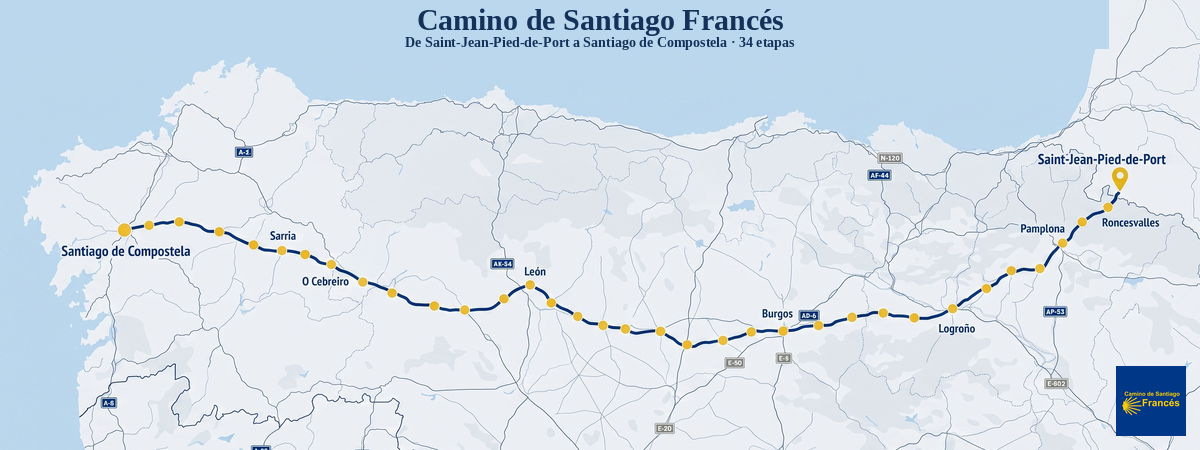
This Camino Frances route map shows the full route at a glance, with all 34 stages and the main towns and cities, from Saint-Jean-Pied-de-Port to Santiago de Compostela.
Where Does the Camino Frances Start and How Long Is It?
The classic kilometre zero is in Saint-Jean-Pied-de-Port (France), though many consider Roncesvalles, already in Navarra, the true Spanish starting point. The finish is always Santiago de Compostela cathedral, in the province of A Coruña, after around 780 kilometres of walking. In between, the yellow arrows cross the initial French stretch and seven Spanish provinces — Navarra, La Rioja, Provincia de Burgos, Provincia de Palencia, Provincia de León, Provincia de Lugo and Provincia de A Coruña — each with its own landscape, food and heritage.
The 34 stages in this list are a reference, not a rule. The classic breakdown splits the effort into days of between 15 and 35 kilometres, worked out around where there’s a bed and food at the end of the day, but every pilgrim can shorten, lengthen or combine stages to suit their fitness, the time of year and how much walking they feel like doing. Each stage in the list above links to its own page, with the elevation profile, the villages along the way, what to see, where to sleep and practical tips for that specific stretch. Below is a portrait of each of the eight main sections of the Camino Frances, to help you decide which stages best fit your time and fitness level.
The Camino Frances Stages, Section by Section
The Camino Frances changes character every few days: it starts by crossing a mountain range and ends under the fine Galician rain, with the Meseta, vineyards and two more mountain ranges along the way. Here’s a portrait of each section, designed to help you decide which stages best fit your time and fitness. Each one links to its full guide, with map, elevation profile and places to stay.
The Pyrenees and the French Stretch
The Camino starts in Saint-Jean-Pied-de-Port, a walled town in the French Basque Country where pilgrims from all over Europe pack their bags and pick up their credencial. The first stage, from Saint-Jean-Pied-de-Port to Roncesvalles, crosses the mountains in one go via the Route Napoleon: over 1,200 metres of climbing up to the Col de Lepoeder, followed by a demanding descent into Roncesvalles, already in Navarra, with its Gothic collegiate church and mountain-refuge atmosphere. It’s the hardest day of the whole Camino and, for many, the most memorable; in snow or fog, walkers take the alternative route through the Valcarlos valley, longer but safer.
Navarra: From Beech Forest to the First Vineyards
In Navarra the Camino drops from the mountains into the valley, following the River Arga. Beech woods and gentle passes lead to Zubiri — the second stage — and then the Esteribar valley on to Pamplona on the third, the first big city on the route, with its walled medieval old town and memories of the Running of the Bulls. From there come the landmarks every pilgrim recognises: the Alto del Perdon and its iron pilgrim silhouettes on the stage towards Puente la Reina, where the Camino Aragones joins the Camino Frances beside its famous Romanesque bridge; the climb to Estella and the Irache monastery with its wine fountain on the fifth stage; and the golden stone villages of Los Arcos, Torres del Rio and Viana on the sixth and seventh, the last before crossing the Ebro. The landscape shifts from Atlantic woodland to wheat fields and the first vineyards, and these stages are of moderate difficulty and very well served with facilities.
La Rioja: Vineyards, Wineries and the Calzada of Santo Domingo
La Rioja is the shortest section of the Camino Frances and takes just over two days to cross, but it leaves some very memorable images: the vineyards around Logroño — the end of the stage out of Los Arcos — and its tapas-lined Calle Laurel; the wineries and pottery village of Navarrete on the way to Najera, former capital of the kings of Navarra, on the eighth stage; and Santo Domingo de la Calzada, the town a sainted engineer built for pilgrims, where the cathedral still keeps a live rooster and hen in honour of the legend of the cockerel, on the ninth. The tenth stage passes through Granon, with its donation-based parish albergue, and crosses into the province of Burgos.
Burgos: The Montes de Oca, the Cathedral and the Start of the Meseta
The entrance to the province of Burgos begins in Belorado, with its arcaded houses. The eleventh stage climbs through the lonely Montes de Oca to San Juan de Ortega, a monastery deep in the forest where, at each equinox, the light illuminates a Romanesque capital. The twelfth passes through Atapuerca, next to the archaeological sites of Europe’s earliest inhabitants, before entering Burgos, whose Gothic cathedral is one of the great artistic highlights of the Camino and a popular rest stop. After that comes the Meseta: the thirteenth stage leads to Hornillos del Camino and the fourteenth to Castrojeriz, at the foot of a hill crowned by a castle, amid wheat fields and very long horizons.
Palencia: The Heart of the Meseta and the Canal de Castilla
Palencia is the flattest, straightest province on the Camino, the one people remember for its endless straight stretches through wheat fields — a monotonous, meditative kind of walking that some love and others endure. The fifteenth stage descends from Castrojeriz, crosses the River Pisuerga and reaches Fromista, whose Church of San Martin is the purest example of Romanesque architecture on the whole route. From there, the sixteenth largely follows the Camino de Sirga alongside the Canal de Castilla and passes through Villalcazar de Sirga, with its fortress-like Templar church, on to Carrion de los Condes. The seventeenth stage tackles 17 shadeless kilometres without a single village along the old Roman road to Ledigos, right on the threshold of Leon.
Leon: From the Meseta to the Montes de Leon and El Bierzo
Leon is the longest province on the Camino Frances and the one that changes the most from start to finish. It begins with the last stretch of the Meseta: Sahagun, historic capital of brick Mudejar architecture and the Camino’s halfway point, on the eighteenth stage; the long straight paths of the nineteenth and twentieth to Mansilla de las Mulas, which still keeps its town walls; and the entrance into Leon on the twenty-first, with its stained-glass cathedral and the Basilica of San Isidoro. After that the terrain breaks up: the twenty-second stage leads to the very long medieval bridge at Hospital de Orbigo, setting of a famous chivalric duel; the twenty-third enters Astorga, with its Gaudi-designed Episcopal Palace and its cocido maragato stew, traditionally eaten starting with the meat; and the twenty-fourth climbs into the Maragateria region to Rabanal del Camino. The twenty-fifth stage passes through Foncebadon and the Cruz de Ferro, the highest point on the whole Camino Frances, where pilgrims leave a stone brought from home, then descends through Molinaseca to Ponferrada and its Templar castle. Already in El Bierzo, the twenty-sixth stage crosses vineyards and orchards to Villafranca del Bierzo, with its Puerta del Perdon, the gateway to the climb into Galicia.
Lugo: The Climb to O Cebreiro and Inland Galicia
The twenty-seventh stage is the Camino’s second big climb: around 700 metres of ascent from Villafranca up to O Cebreiro, the village of stone pallozas with thatched roofs that acts as the gateway into Galicia. From here the Camino fills with chestnut woods, damp corredoiras (sunken lanes) and traditional granaries. The twenty-eighth stage descends through the mountains to Triacastela, and the twenty-ninth lets you choose between the direct route via San Xil or the detour to the Benedictine monastery of Samos, one of the oldest in the West. Sarria is where most pilgrims join the Camino — it’s just over 100 kilometres from Santiago, the minimum distance required for the Compostela — so from the thirtieth stage onwards, which descends to the reservoir and the rebuilt village of Portomarin, the Camino gets noticeably busier. The thirty-first links gentle ups and downs on the way to Palas de Rei, almost in the province of A Coruna.
A Coruna: The Final Kilometres to Santiago
The final stretch, in the province of A Coruna, is a constant up and down through hamlets, eucalyptus groves and streams. The thirty-second stage passes through Melide, famous for its pulperias (octopus restaurants), and ends in Arzua, cheese country with its own Denominacion de Origen. The thirty-third leads to O Pedrouzo, the last stop before the finish. And the thirty-fourth and final stage crosses Monte do Gozo — where the cathedral towers come into view for the first time — and enters Santiago de Compostela through the old town, all the way to the Praza do Obradoiro. That’s where the Camino Frances ends, with the arrival at the tomb of the Apostle Saint James, the traditional embrace of his statue and, for those who want it, the pilgrim’s mass and the paperwork for the Compostela.
How to Use This Camino Frances Stages Guide
No planning is compulsory. Pilgrims with less time join short stages together; those taking it slowly split others in two. What is worth doing is checking each day’s elevation profile in advance, knowing where the real climbs are — the first stage, the Cruz de Ferro and O Cebreiro — and booking a bed ahead on the stretches with fewer places. That’s what each stage page is for: open the one you’re interested in from the list above and you’ll find its detailed route, the villages along the way, what to see, where to sleep and practical tips for that specific day on the Camino.